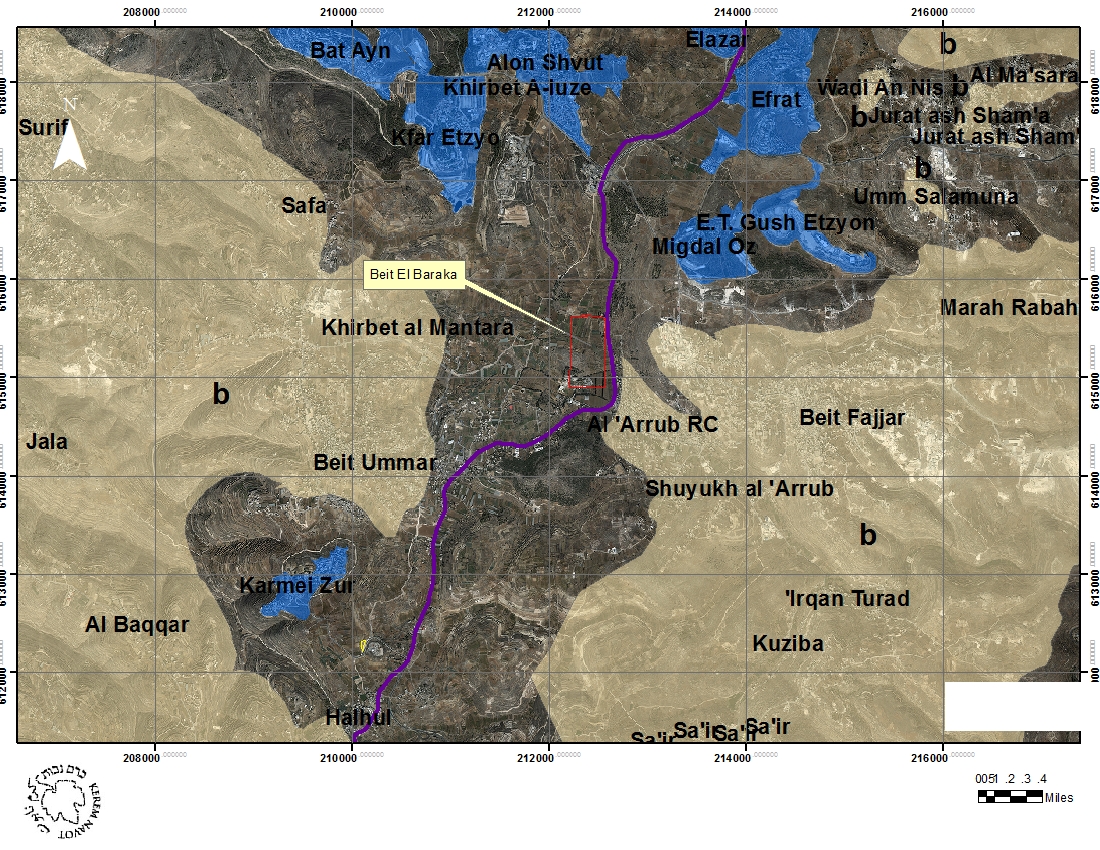
Location
Beit El Baraka (the house of the blessing in Arabic) is a compound of ca. 40 dunams located on a strategic spot right on the historical main road between Bethlehem and Hebron also AKA: bypass route 60 – linking the 2 main Palestinian cities in the southern part of the West Bank – few hundred meters north to El Arub Refugee Camp (RC). The compound is located within the historical land of the village of Beit Omar, on an area (Mawqa'a) which is known as "Furadis" (فراديس), around 3 km northeast of historical core of the village. "El Furadis" area is a valley which is one of the most intensively cultivated areas of Beit Omar, covered mainly with vineyards and other fruits orchards.
The compound is also located between the Israeli massive settlements of "Gush Etzion" (the Etzion Block), southwest of Bethlehem, and the settlement of Karmei Tzur located between Beit Omar and the Palestinian town of Halhul.[1]
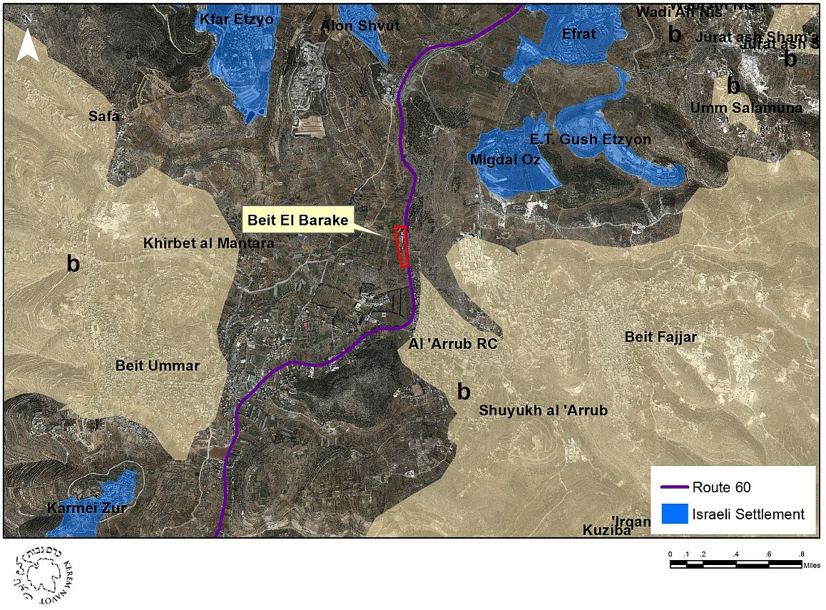
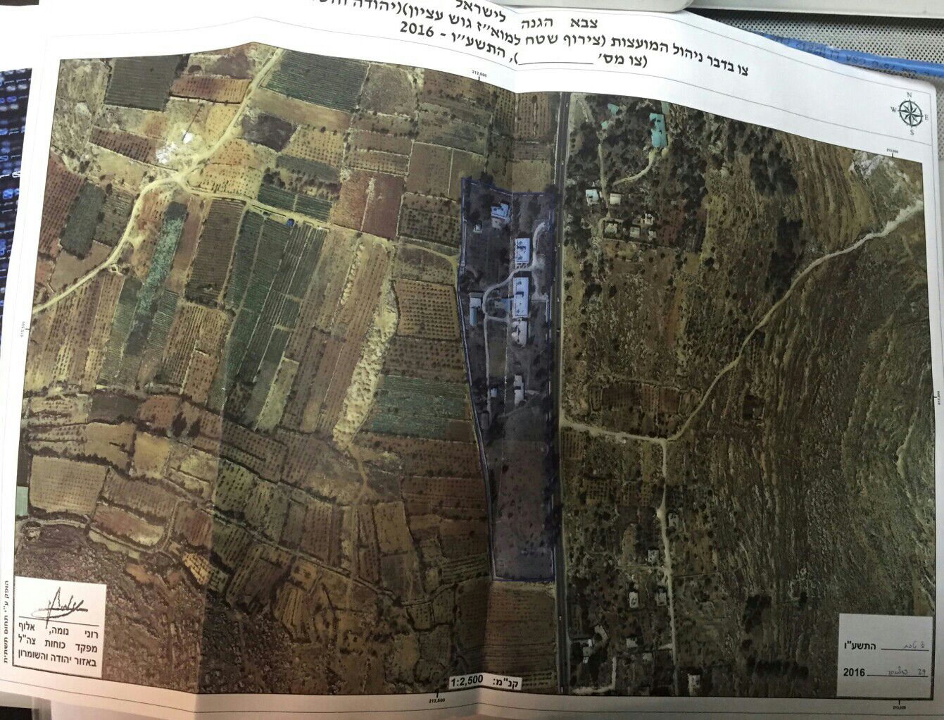
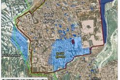
Map 1: The vicinity of Beit El Baraka
Brief History of the compound from the end of the 1940's until it was delivered to settlers hands
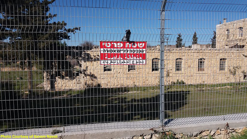
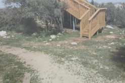
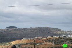
Beit El Baraka compound includes 8 several buildings (1 main building and several smaller), which were built up from the late 1940ies by Thomas Lambe an American Christian missionary which was also a physician, who established a tuberculosis hospital in the place. After Lambe's death in 1954 the compound was handed over to the Presbyterian Church which operated in the compound a pilgrim hostel, which was closed in 1995 because of lack of sustainability. In 2010 the property was sold to a Swedish straw company "The Scandinavian Seaman Holy Land Enterprises" which was originally established by the settlers’ patron Irving Moscowitz in order to purchase this property. The Swedish company was dissolved soon after it was purchased by the "American Friends of Everest Foundations", which Moscowitz uses as a channel to deliver funds to different settlements enterprises. In 2012 the property was registered in the ICA offices as the property of the "American Friends of Everest Foundations".
The "settlement mosaic"
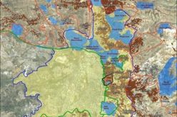
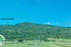
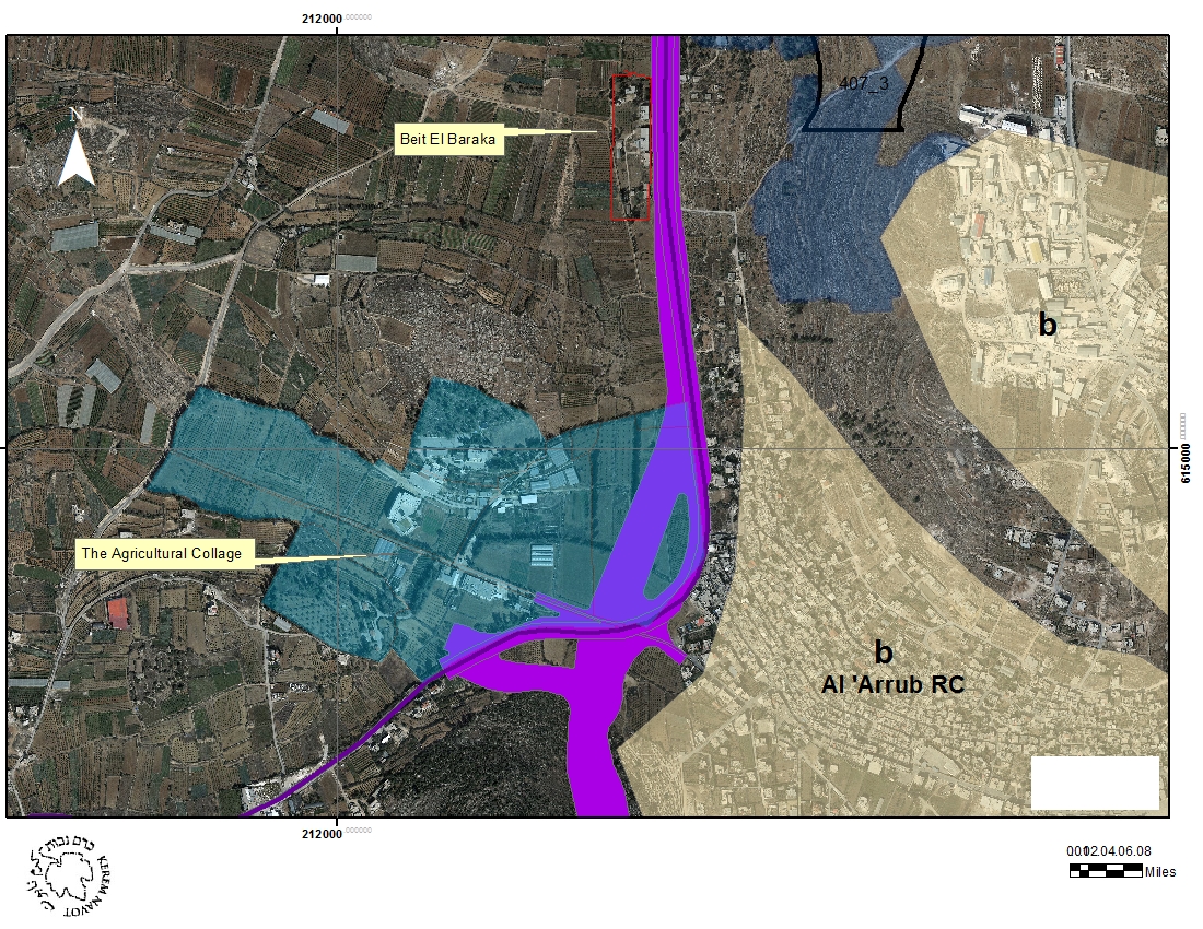
A careful observation of the status of land around Beit El Baraka compounds shows that is part of wider expansion plan of the Israeli authorities in the area. From both sides of the compound there are hundreds of dunams of State land, which theoretically could be used by the Israeli authorities for the expansion of "Gush Etzion" settlements farther south. Hundred m north of Beit El Baraka there is an area of 500 dunams which was declared by the Israeli authorities as state land and was allocated to the settlement of Migdal Oz. There are several clear indications that the Israeli authorities are planning to build in this area.[2]
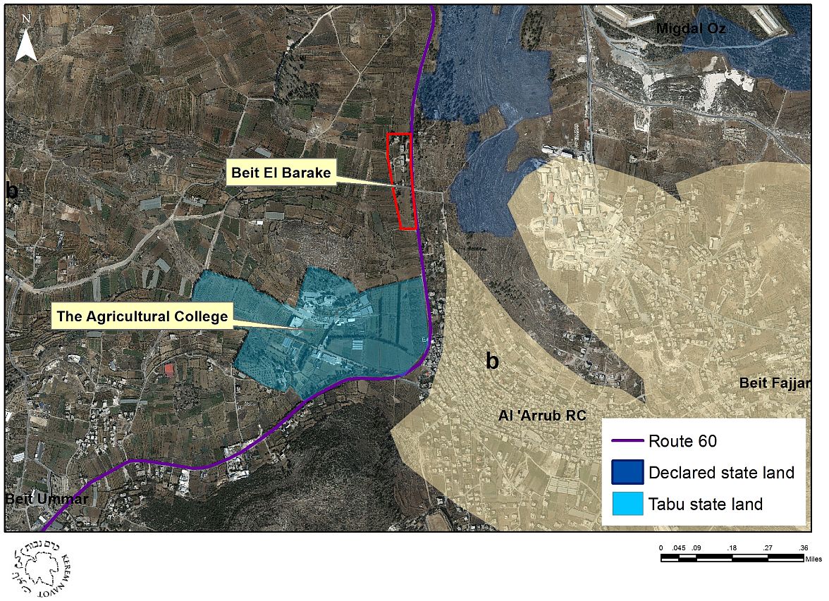
Map 2: Israeli State Land Around Beit El Baraka
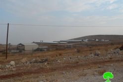
200 m south to Beit El Baraka compound there is another block of state land which today is allocated to the agricultural collage which is on the opposite side of the entrance to El Arub RC. Although there is no indication for the time being that the Israeli authorities are planning to use this land for settlement construction, we do know that ca. 65 dunams of the collage land are planned to be taken for a new bypass road which the Israeli authorities are planning to build in order to bypass El Arub and Beit Omar.
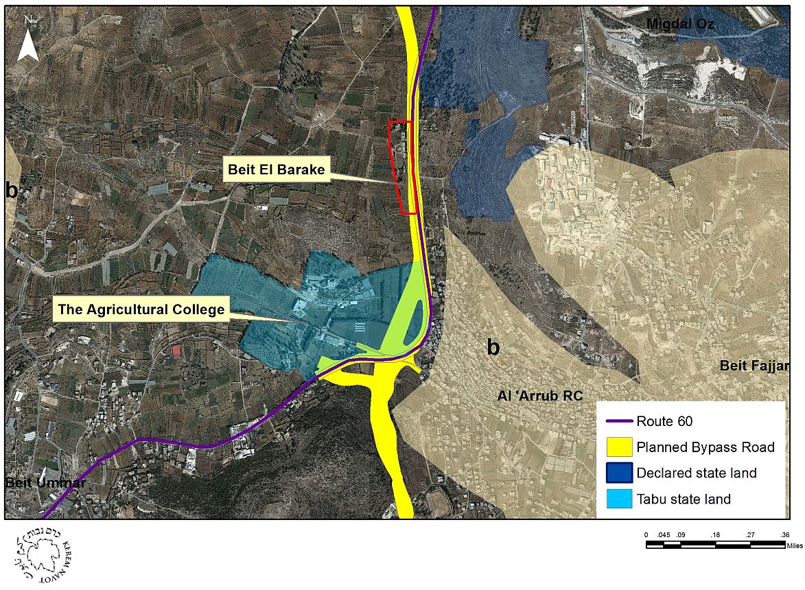
Map 3: The new bypass road which is planned to be build partly on the land of the agricultural collage
The discovery of the story and the retroactive legalization of the new settlement site
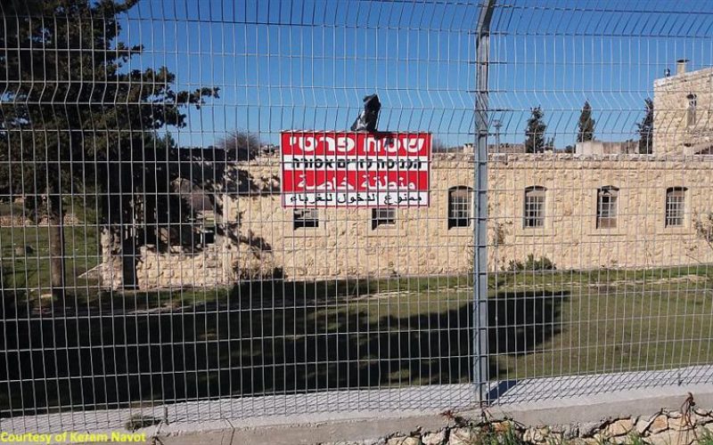
During May 2015 it was revealed that the settlers are secretly renovating the compound of Beit El Baraka. The story was later published by Haaretz and was followed up by hundreds local and international media organs.[3] The works in the compound were disguised as if they are being done by the local church owners. After the publication the works had stopped for IDF started openly to assist in the guarding of the place.[4] Few months later the Israeli Minister of Defense had officially ordered the annexation of Beit El Baraka compound to the "Gush Etzion Regional Council". The compound had been officially annexed to Gush Etzion on the 29th of Dec 2015.[5]
[1] Karmei Tzur settlement was established in 1984, is officially part of the so called "Gush Etzion Regional Council", but is not one of the 4 Jewish communities which existed prior to 1948 war. The location of the Karmei Tzur settlement was chosen in order to separate between Beit Omar and Halhul. For more details see: http://peacenow.org.il/eng/content/gush-etzion
[2] In 2005 the ICA conducted a "Blue Line" survey in this area which is done in cases that there are concrete plans to build on a virgin land. This Blue Line server was done probably in order to promote master plan 407/3 which the WZO had promoted in order to allow the expansion of Migdal Oz settlement in this area.
[3]C. Levinson, "Settlers Turning West Bank Church Compound Into New Outpost", Haaretz, May 22 2015, http://www.haaretz.com/israel-news/.premium-1.657700
[4]Apparently the local IDF soldiers and officers didn't know about the renovations of the compound by settlers until the story was made public. The reason is that the settlers were afraid that the information will be licked and publish before that they will be ready to move in what eventually happened anyway.
[5] C. Levinson, "Israeli Defense Minister OKs Addition of West Bank Church Compound to Settlement Bloc", Haaretz January 6 2016, http://www.haaretz.com/israel-news/.premium-1.695735.
Prepared by
Kerem Navot
