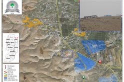
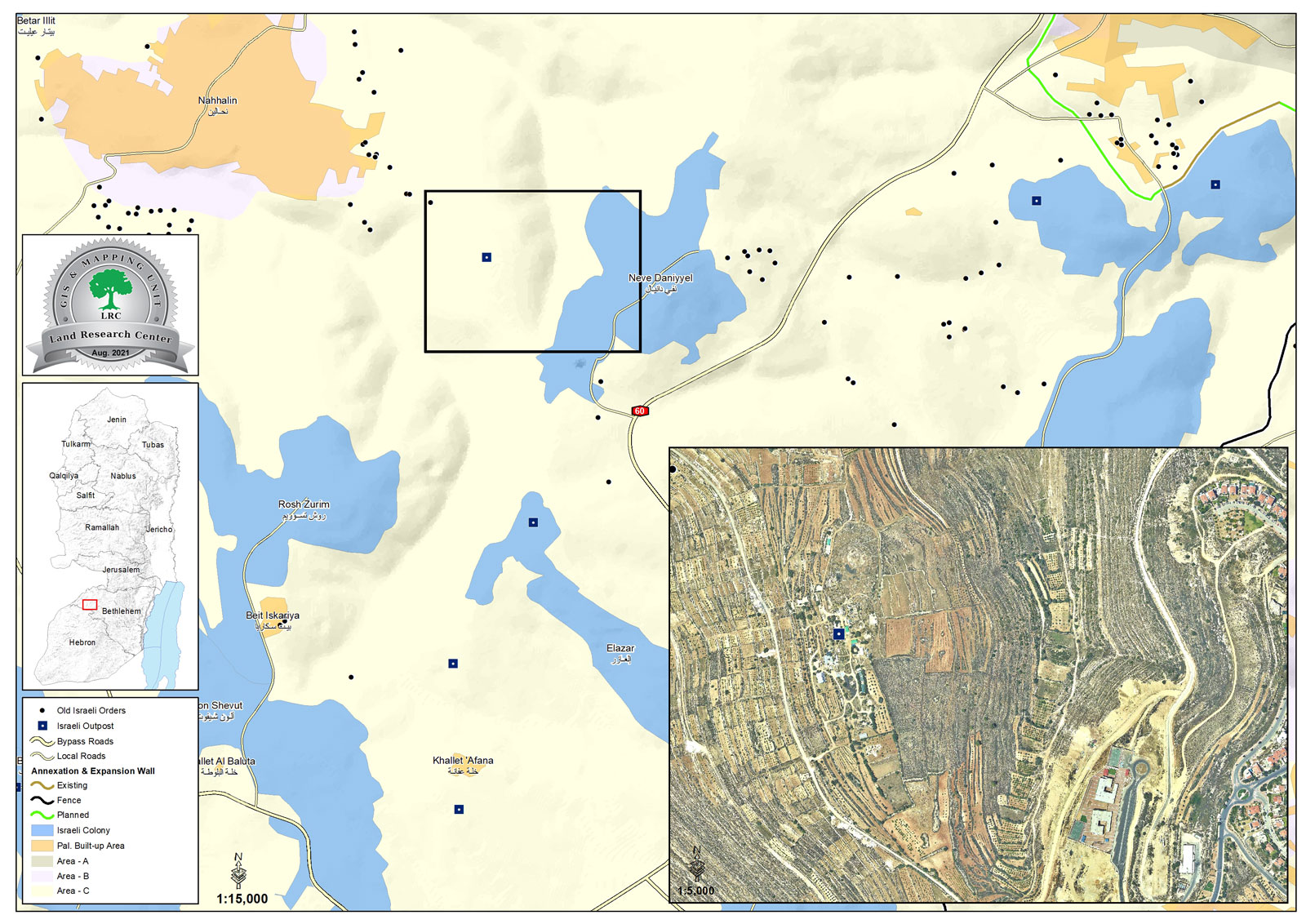
- Violation: Establishing a new outpost.
- Location: Sa’eb area – Khader town / Bethlehem Governorate.
- Date: June 9th 2021.
- Perpetrators: colonists of “Neve Daniel”.
- Victims: Citizens of Al-Khader and Nahhalin.
Description:
Wednesday, June 9th 2021, the Israeli Occupation bulldozers carried on ravaging vast areas of lands nearby Neve Daniel colony, and carried on building a wall around the ravaged lands of Al-Khader in order to impose their full control and ban Palestinian owners’ access to the lands.
Mr Iyad ‘Issa from Al-Khader town told LRC:
“Neve Daniel colony is continuously expanding on Al-Khader lands. The Occupation’s intention is to increase number of Israeli illegal colonists on lands between Nahalin and Al-Khader, and expand the colony on the mountain that overviews Nahalin.
In addition, new caravans were added on a plot that opposes the colony, which imposes a threat on the lands between the colony and the caravans, the Palestinian owners of the lands are no longer allowed to access them on the pretext of protecting the colony’s Security.”
The targeted lands belong to many families from Al-Khader and Nahalin, and are the only area were people of Nahalin can expand and build new structures.
The new outposts in Nahalin are illegal and built on a private property, and is Part of the Israeli continuously growing colonization in the West Bank that violates many international conventions and agreements.
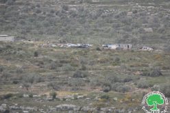
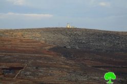
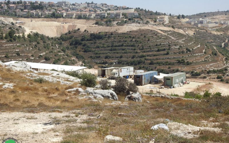
 Photo 1: The new caravans
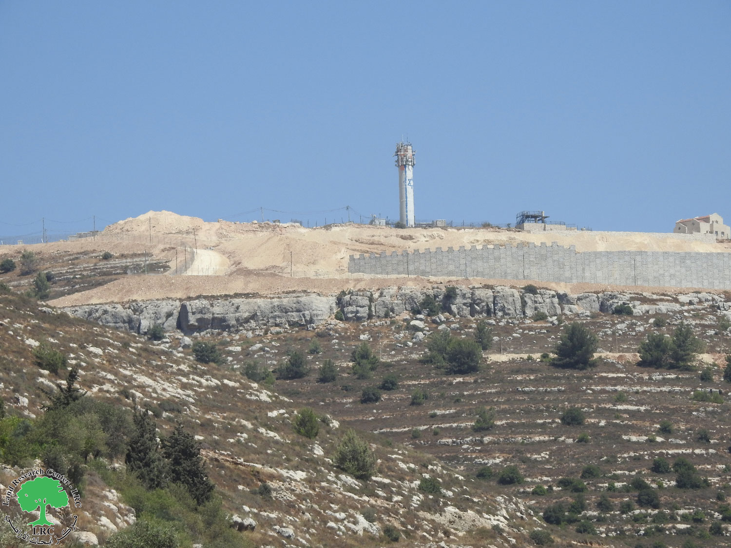
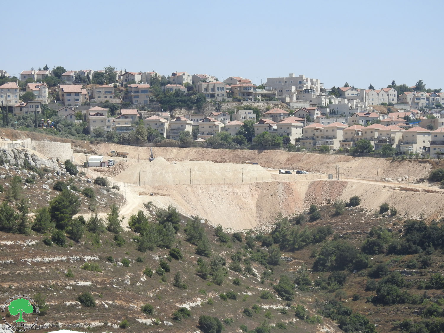
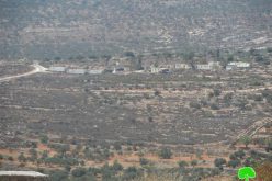
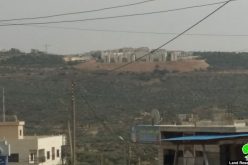
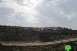
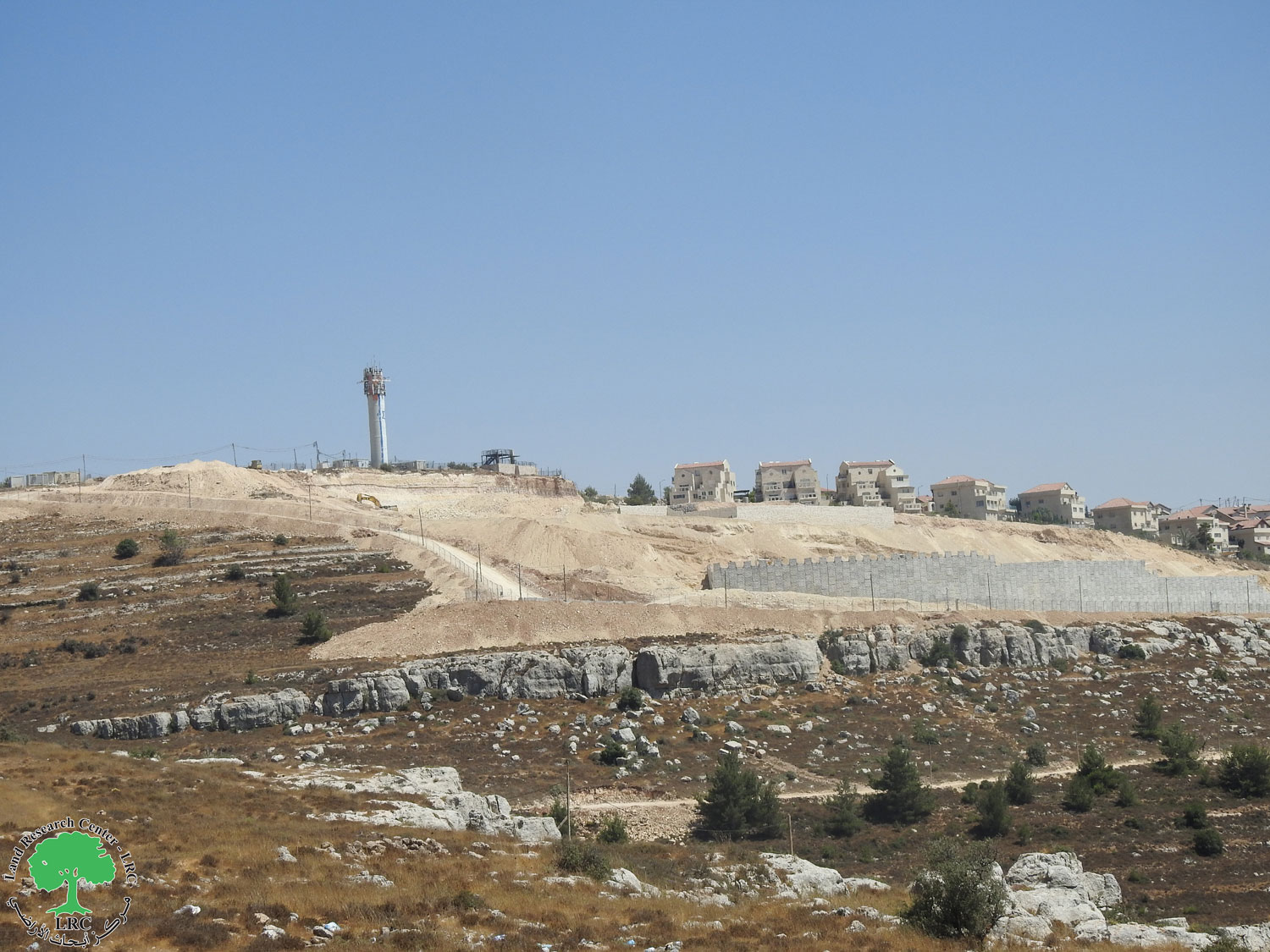 Photos 2-4: expansions in the colony
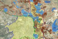
About Al-Khader village:[1]
Al-Khader village is located 4 km from the western side of Bethlehem, it is bordered by Beit Jala and Batir from the north, Hussan and Nahaleen villages from the west, Aldoha, Wadi Rahhal, Beit Jala villages from the east, and Wadi Al-Nees from the south. Its population is 11960 people in 2017. Its gross area is 8,279 donums; 184 of them are the construction area.
The Israeli colonies have despoils 29 donums from the village’s lands; two are colonies existed upon a part of the lands. The first one ” Efrat” was constructed in 1979 A.D; they have usurped 5.8 donums, and its population 7037 colonists. The second one ” Nafy Danial” eas constructed on 1982A.D; they have usurped 23 donums, and its population is 1073 colonists. A part of which is established upon the village’s lands.
The bypass roads number 60 and 375 also despoiled more than 487 donums. In addition to establishing the apartheid upon its lands which causes the demolishing of 280 donums and isolating of 5638 donums behind it. The length of this apartheid existing upon the village’s land is 2,805 meters.
The village’s lands are classified in accordance with Oslo concord into areas(A,B ,C). Area A composes 10% , Area B 6%, Area C is the greatest area and it is under the total occupation domination, and it composes 84% from the total area. The areas are clarified in donums as following:
- Area A (808) donums.
- AreaB (475) donums.
- Area C(6,996) donums.
[1] GIS-LRC
Prepared by
The Land Research Center
LRC