- Violation: Closure of a main road.
- Location: Deir Istiya town north Salfit City.
- Date: June 10th 2021.
- Perpetrators: The Israeli Occupation Forces.
- Victims: People of the village.
Description:
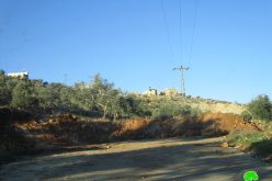
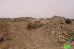
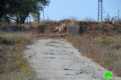
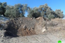
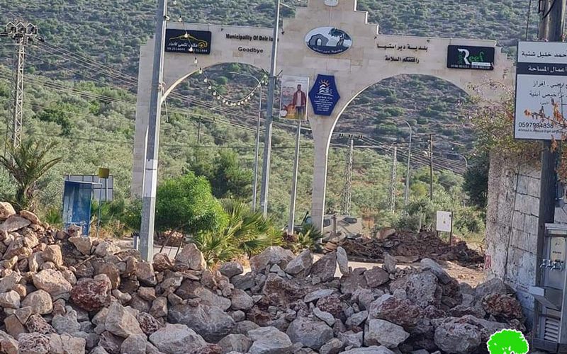
In the Early morning hours of Thursday, June 10th 2021, the occupation forces closed off the western entrance of Deir Istiya via earth mounds. At the same time, the occupation army announced the area of the entrance as a closed military zone.
This is a continuation of an Israeli plan to impose realities on the ground, a new outpost in “Khirbet Shehadeh” along with mass marches against establishing the outpost that ate up vast areas of Deir Istiya and Qarawat Bani Hassan. In other words, the occupation bans Palestinians from the area in every possible way.
Activist Nathmi Salman in Deir Istiya town told LRC:
“The Western entrance of Deir Istiya is a vital road, people of the village take it to move between cities. the entrance also connects the town to hundreds of agricultural dunums in Wad Qana. Consequently, the occupation is perpetuating a crime through prohibiting Palestinians from accessing their lands.”
Deir Istiya western entrance is an ancient road, the occupation targeted it many times. The road was closed off for 10 years after the Second Intifada, which had a devastating impact on the agricultural sector.
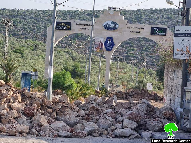
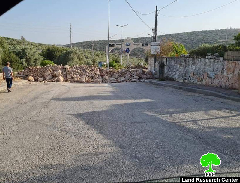
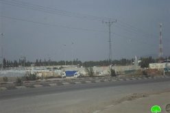
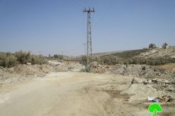
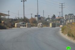
 Photos 1-3: Closure of a road in Deir Istiya
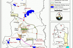
Deir Istiya village:[1]
10 km north Salfit , Deir Istiya is surrounded by Ematin , Jinsafut and Kafr Laqif (north), Azzun and Kafar Thulth (west), Zita, Jama’en and Kafl Haris (east), Haris and Qaraqwat Bani Hyssan (south)
Deir Istiya has a population of (3,696) people in 2017 census.
The town has a total area of 34,125, of which 640 dunums are a built up area.
The Israeli occupation confiscated (4,257) dunums for the following purposes:
|
Settlement name |
Establishment year |
Area in dunums |
Number of settlers 2018 |
|
Revava |
1991 |
167 |
2,664 |
|
Yakir |
1981 |
757 |
2,341 |
|
Ginat Shomron |
1985 |
944 |
NA |
|
Karnei Shomron |
1978 |
540 |
8,388 |
|
Novim |
1986 |
663 |
867 |
|
Immanuel |
1981 |
879 |
4,220 |
|
Ma’ale Shomron |
1980 |
52 |
1,002 |
|
Al-Matan |
1981 |
22 |
NA |
Bypass roads 55 and 5066 devoured 118 dunums.
The segregation wall (1,148 m ate up115 dunums , in case its construction plan was completed it will isolate 8,408 dunums and eat up 160 dunums.
Oslo accords classified Deir Istiya as the following :
- B area : 6,132 dunums.
- C area 27,993 dunums.
[1] GIS-LRC