- Violation: The Israeli Occupation builds a new colonial block.
- Location: Deir Ballut town / Salfit Governorate.
- Date: March 1st 2021.
- Perpetrators: “Leshem” Colony.
- Perpetrators: Farmers of Deir Ballut.
Description:
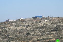
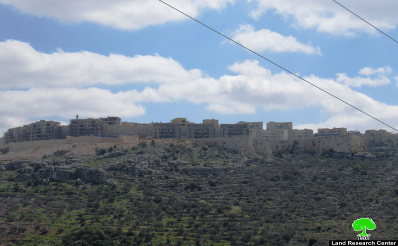
The Israeli Occupation carry on ravaging works for the expansion of Leshem Colony on Deir Ballut lands west Salfit. In March 1st 2021, Israeli Bulldozers carried on ravaging works to build a new colonial block north Leshem colony, about 80 residential units are under construction, and infrastructure is under development, noting that the targeted lands were confiscated in the nineties and declared as state properties.
The Colony largely expanded in the past five years, through establishing many residential units, road network, and advanced public facilities.
The Colony’s outline expands on the whole area of Bab Al-Marj , and Deir Ballut plains on about 10,000 dunums . The Occupation authorities claim that the plot is an “Israeli State property”, while in fact the lands are private Palestinian properties confiscated compulsorily under unjust military orders.
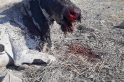
Citizen Ahmed Abdullah (44) who lives nearby the illegal Colony Leshem said: “We are living in danger that threats our whole existence, at the time “Leshem” colony expands on the town’s lands, the Occupation imposes heavy restrictions on 17 families living at Bab Al-Marj area, in order to prohibit new constructions or rehabilitation of buildings, in addition to serving halt of work notices for 11 houses and a mosque, which together form a complete forcible displacement plan.”
About Deir Ballut:[1]
24 km west Salfit, Deir Ballut is surrounded by Rafat village (north), The green line – occupied territories of 1948 (west), Kafr Ad-Deek village (east), Al-Lubban Al-Gharbi village (south).
- Deir Ballut is populated 3,870 people in 2017 census. The town’s people are from several families, namely: Tufaha, Khair, Abdullah, Qassim, Qaroush, Mesha’l, Mustafa, Musa and Hadrous.
- Deir Ballut has a total area of 11,339 dunums , of which 503 dunums are a built up area.
- Deir Ballut is popular with rain-fed agriculture such as (Armenian cucumber, Ladies fingers, garlic and others), in addition to olives and wheat.
- Deir Ballut contains a water spring in Wadi Al-Ein area, and the town’s people depend on the National Israeli water company, in addition to rain water harvest cisterns for daily use water.
Oslo accords classified the town’s lands as the following:
– B area: 689 dunums.
– C area: 10,710 dunums.
[1] GIS-LRC
The Land Research Center
LRC