Israel plans to extend the boundaries of Jerusalem and de- Palestinianize the local population in the occupied West Bank and East Jerusalem to consolidate Israel’s larger plan of a “Greater Jerusalem”.
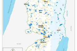
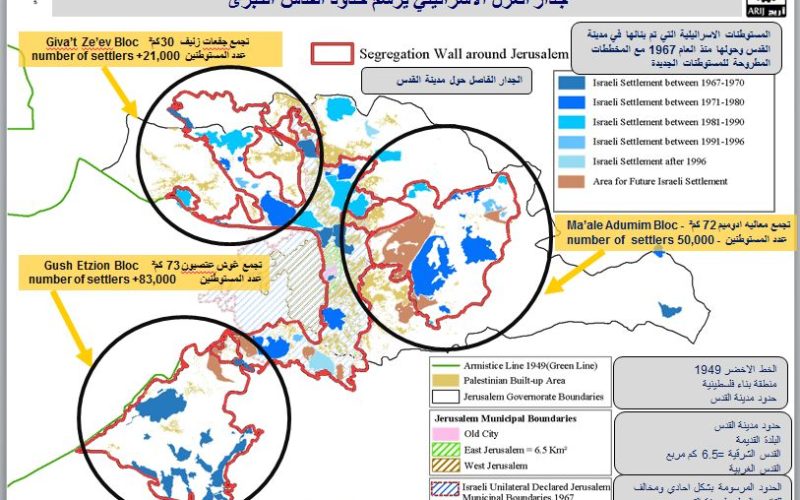
The Greater Jerusalem Plan necessitates annexing the three major settlement blocs that surround Jerusalem city – the Gush Etzion settlement bloc in Bethlehem and Hebron Governorates consisting of 11 illegal settlements, spanning an area of 73 km2 and with a population of more than 83,000 Jewish settlers; Ma’ale Adumim settlement bloc in East Jerusalem with an area of 72 km2 and with a population of over 50,000; and the Giv’at Zeev settlement bloc northwest of Jerusalem city with an area of 30 km2 and a population of over 21,000.
According to the Greater Jerusalem Plan, Israel plans to extend these settlements and further the de-Palestinanization of its populations. The Palestinian communities within the boundaries of the “Greater Jerusalem Plan”. This plan will further the de-Palestinianization of Jerusalem and
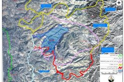
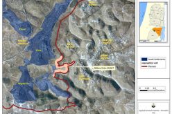
the West Bank by ensuring Palestinians are unable to continue their livelihoods by making their access to Jerusalem increasingly difficult and time-consuming. See Map 1
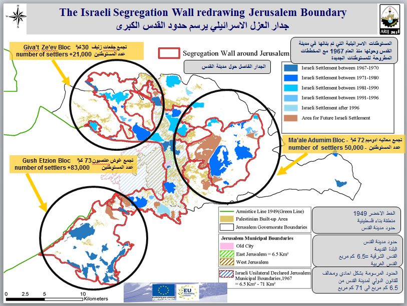
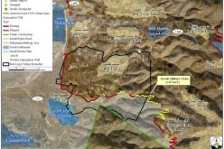
Map 1: The Israeli Segregation Wall redrawing Jerusalem Boundary
Prepared by
The Applied Research Institute – Jerusalem