The Israeli Occupation Demolished an Agricultural Facility in Khirbet Ghuwein / Hebron
- Violation: demolishing an agricultural facility.
- Date: 16/07/2019.
- Location: Ghuwein – As-Samou’ town/ Hebron governorate.
- Perpetrator: The Israeli occupation civil administration.
- Victims: family of Ahmad Hawamda.
Description:
Monday, 16 July 2019, the Israeli occupation authorities demolished an agricultural facility belongs to Ahmad Hawamda in Khirbet Ghuwein south As-Samou’ on the pretext of building without licenses.
A force from the Israeli occupation accompanied by a staff from Planning and Construction Committee- Israel Civil Administration and a Caterpiller bulldozer raided the Khirbet and demolished the facility.
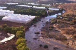
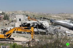
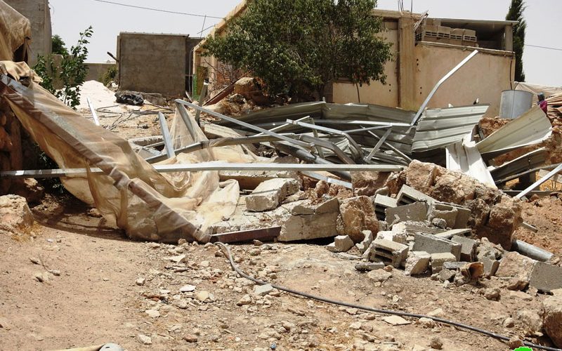
Reportedly, the targeted facility is a barracks built of bricks and plastic sheets, it has an area of 85 m and used for cattle breeding, it was constructed in April 2019.
 Photos: 1+2: the facility after the demolition
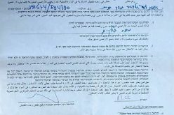
In 3/7/2019, the occupation authorities issued military order No (10262 ) entitled “A notice to remove a new building” , and requested returning the land to its previous status within 96 hours.
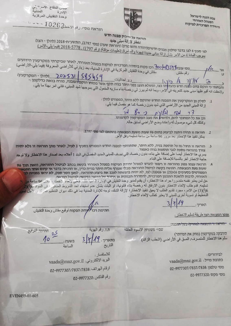 Photo 3: The military order
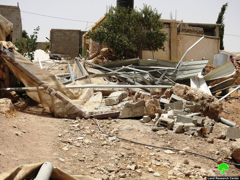
 Photo 4: The facility before the demolition
The owner prepared the legal file and filed for licensing in the civil administration, and hired a lawyer to follow up the case . But as expected, the occupation authorities refused the application, and carried out the demolition in 16/7/2019.
The notice came in reference to military order (1797) issued in 2018 that targets new structure and facilities, military order (1797) targets houses inhabited for a period less than a month, and structures that are not all set within 6 months in C area.
Noteworthy, The Israeli authorities never gives Palestinian licenses in C area, even though they have legal documents prove they own the lands. It is also worth mentioning that built up areas in Palestinian communities and villages are too small compared to natural demographic growth.
This is a clear violation of international agreements and conventions, the Israeli occupation issued military laws in the Palestinian territories that go in line with their colonial schemes.
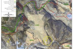
About Khirbet “Ghuwein Al-Fouqa”:[1]
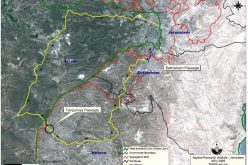
The Khirbet is located 45 km south Hebron, and 6km south to Samou’ town and is considered part of it. The Khirbet is linked to Samou’s by a rough uneven agricultural rood that crosses the bypass road no.317. Ghuwein is bordered by As-Samou’ (north) , Khirbet Zenota (west), Imnaizel (east) and the green line – The occupied territories of 1948 (south).
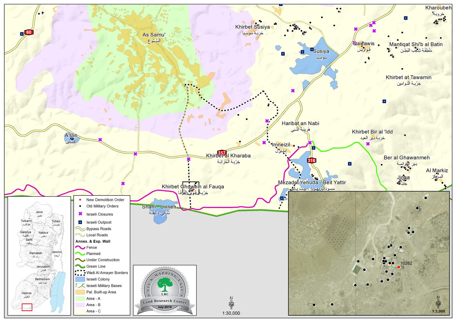 From the east of Ghuwein, there is Metzodat Yehuda- Beit Yatir, and from the south there is Shani- Levni. As for the north; there is bypass road 317, there is also the apartheid wall (3,833m long) which ate up under its route about 383 dunums and isolated 805 dunums.
Khirbet Ghuwein is located within the area of Wadi Al-‘Amayer which has an area of 8,075 dunums, of which 8.3 dunums are Ghuwein’s built up area.
With no kind of services available in the Khirbet, villagers fully depend on agriculture and animals breeding. The Khirbet underwent several assaults from the Israeli occupation that as a matter of fact has closed its main gates by dirt and blocks. In addition, the electricity network of the village was demolished as well.
Therefore, the resident of the village demanded on the human rights organizations to step in and stop the occupation activities against them as well to provide them with a new electricity network. But the occupation prohibits any developmental projects in the area, with the intent to halt demographical growth and keep the Khirbet a reserve for colonial expansion.
[1] GIS-LRC
Prepared by
The Land Research Center
LRC