The Israeli Occupation Notifies a Barn in Ghuwein Hamlet – South As-Samou’ / Hebron Governorate
- Violation: notifying a barn.
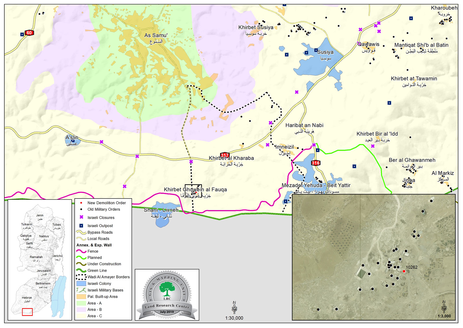
- Date: 03/07/2019.
- Location: Ghuwein – As-Sumou’/ Hebron governorate.
- Perpetrator: The Israeli occupation civil administration.
- Victims: citizen Ahmad Hawamda.
Description:
Wednesday, 3 July 2019, the Israeli occupation authorities notified a newly constructed barn of removal within 96 hours, on the pretext of building without licenses.
Reportedly, a vehicle related to the building and organizing department in the civil administration raided the area and handed the notice to owner Ahmad Hawamda.
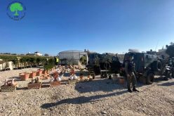
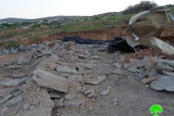
Reportedly, the targeted structure built of bricks, plastic sheets and steel sheets, it has an area of 85 m2 and used a barn.
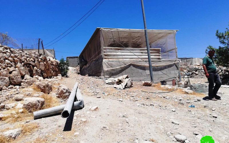
The notice (10262) entitled “a notice to remove a new building” requested the removal of the unlicensed structure within 96 hours.
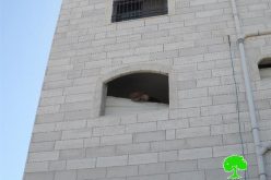
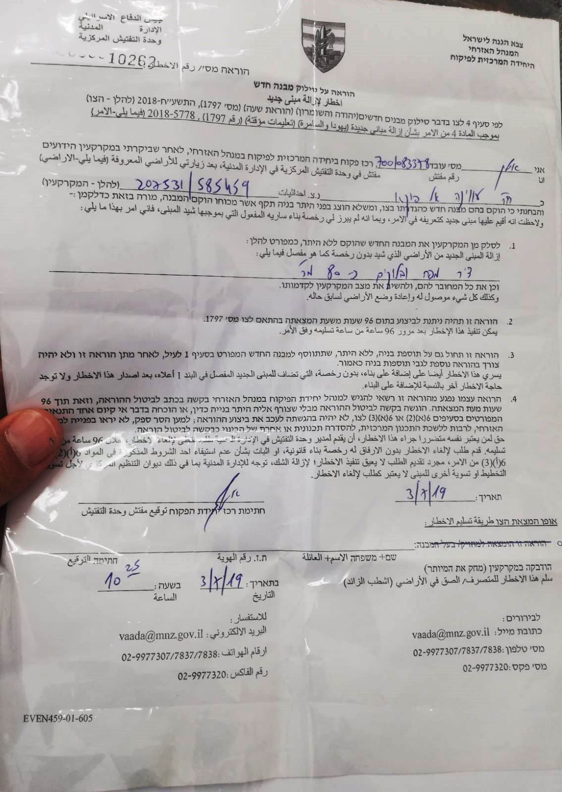 Photo 1: The military order
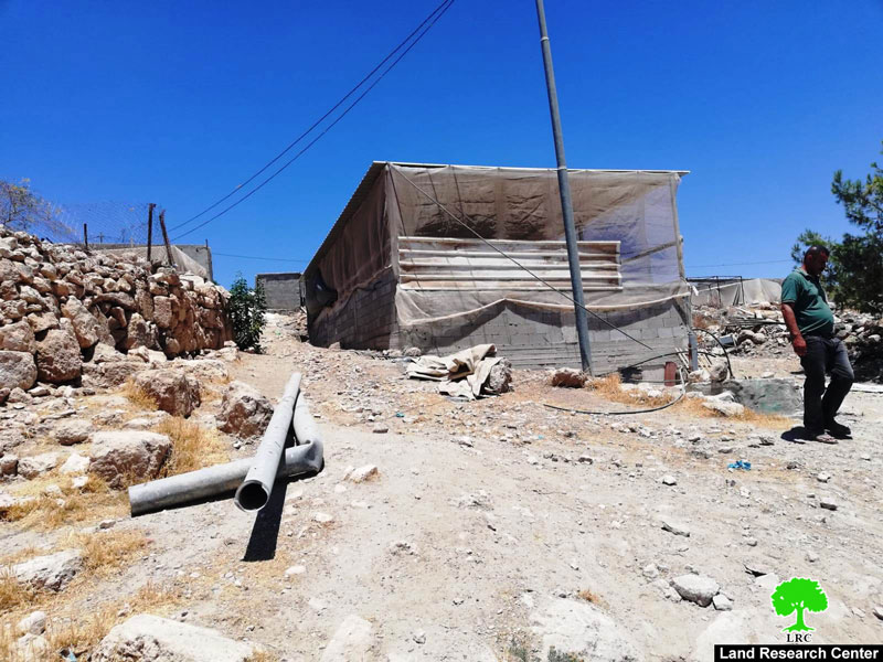
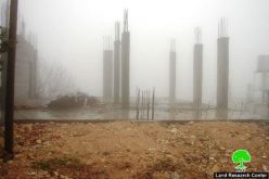
 Photos 2+3 : the targeted barn
The notice came in reference to military order (1797) issued in 2018 that targets new structure and facilities, military order (1797) targets houses inhabited for a period less than a month, and structures that are not all set within 6 months in C area.
Noteworthy, The Israeli authorities never gives Palestinian licenses in C area, even though they have legal documents prove they own the lands. It is also worth mentioning that built up areas in Palestinian communities and villages are too small compared to natural demographic growth.
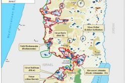
About Ghuwein :[1]
The village is located 6km south to Samu’ town and is considered part of it. It has a total population of 120 families of Hawamdeh and Dghamin. The Khirbet is linked to Samu’s by a rough uneven agricultural rood that crosses the bypass road no.317. With no kind of services available in the Khirbet, villagers fully depend on plantation and animals breeding. From the west of Ghuwein, there is Shani Levni colony, and from the east there is al-Kharaneh area. As for the north; there is Samou’ and a bypass road where from the south; there is the apartheid wall which was founded on more than 1000 confiscated dunums of the village.
The Khirbet underwent several assaults from the Israeli occupation that as a matter of fact has closed its main gates by dirt and blocks. In addition, the electricity network of the village was demolished as well.
Therefore, the resident of the village demanded on the human rights organizations to step in and stop the occupation activities against them as well to provide them with a new electricity network.
About Samou’: [2]
The town is located 18km from the southern part of Hebron city. Form the north; there are Yatta town, Aziz, and al-Manather and from the east; there is Susya colony. Khirbet al-Harabeh and Ghuwein are there from the south.
The town has a population of 26,011 people until 2017 and has a total area if 45250 dunums, 93 of which are the built-up area.
The Israeli occupation has confiscated 2786 dunums explained as follows:
- 284 dunums were confiscated for the favor of the following colonies:
- Shim’a colony that was established in 1985 with a population of 357 colonists confiscated 37 dunums.
- Shale Levni hat was established in 1989 with a population of 438 colonists confiscated 37dunums.
- Ezlien colony that was established in 2004 confiscated 94 dunums.
- The bypass roads no. 30, 317, 3178 confiscated 1610 dumums.
- The apartheid road confiscated 892 dunums and segregated more than 1065 dunums. Noteworthy, the wall is of 18215m in length.
Smau’ roads, according to Oslo Accords, are classified as follows:
- 12702 dunms are classified as area A
- 9947dunums are classified as area B
- 22479 dunums are classified as area C
[1] GIS-LRC
[2] GIS-LRC
Prepared by
The Land Research Center
LRC