Abstract
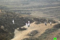
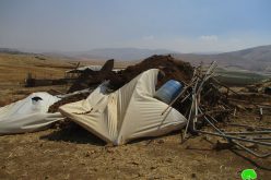
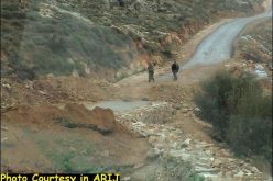
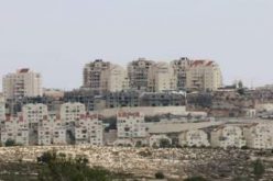
Since the displacement of Al-Walaja’s residents from their original home in Jerusalem during the war of 1948, about 100 out of 1600 villagers resettled on the adjacent hill. After the war of 1967, the Israeli government redrew Jerusalem’s boundaries, seizing a significant part of the village. The remaining Palestinian residents of Al-Walaja were subject to a prolonged process of restrictions limiting urban and demographic expansion. Until the Interim Agreement “Oslo II” in 1995, the village was classified into two areas: 3% “Area B” and 97.4 % “Area C”. Residents are allowed to develop and reside without prior military permission only within area “B.” Therefore, those in area “C,” which is fully controlled by the Israeli authorities, face constant threat of displacement. Moreover, Israel denies their right to live in the area that was seized in 1967. In 2006, the Israeli Civil Administration informed residents about the construction of the Separation Wall, which cuts the village off from its surrounding vicinity. As a result, they have suffered from land confiscations and house demolitions specifically within area “C.” This strategic plan aims at isolating the village as much as possible to annex the vacated land and expand the surrounding settlements “Gilo,” “Har Gilo,” and “Giva’at Yael.” This study analyzes the consequences of the ongoing restrictions on the village and Israeli pretexts behind this plan.
To reads full article , CLICK HERE
Prepared by:
The Applied Research Institute – Jerusalem