Israeli Occupation Forces uproot and confiscate 400 olive trees in Salfit governorate
- Violation: uprooting and confiscating trees
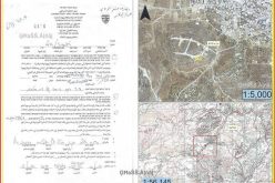
- Location: Wad Qana area- Salfit
- Date: August 01, 2017
- Perpetrators: Israel Nature Authority
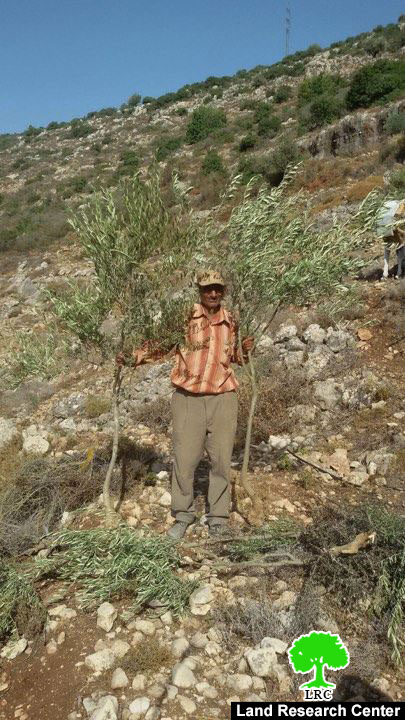
- Victims: Farmer Ali Abu Ali
Details:
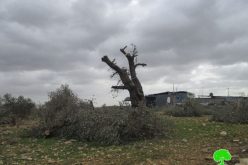
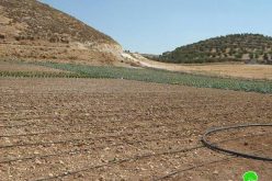
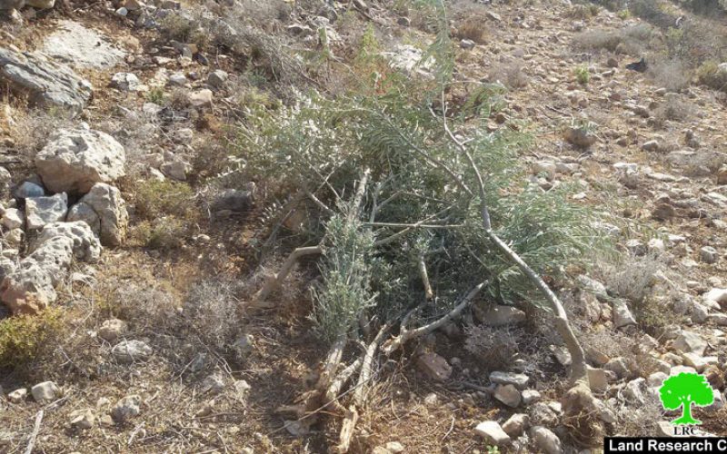
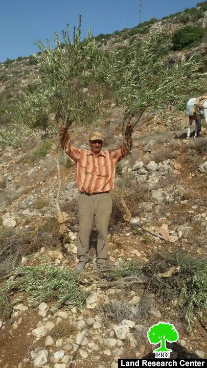
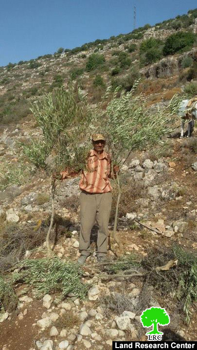
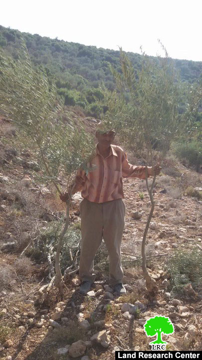
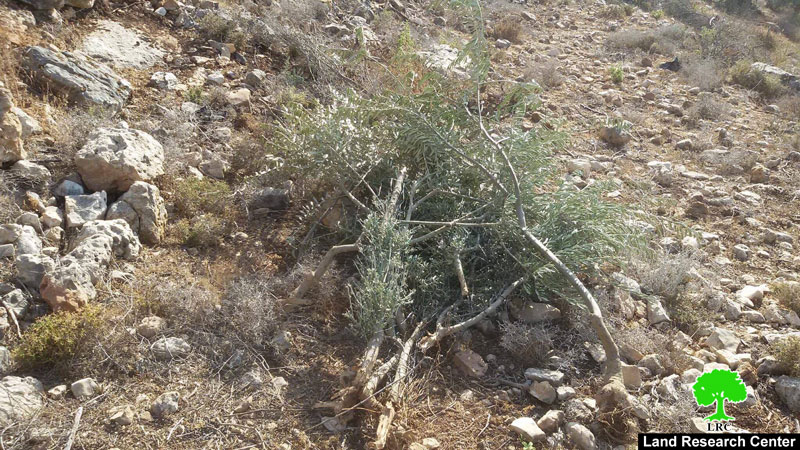
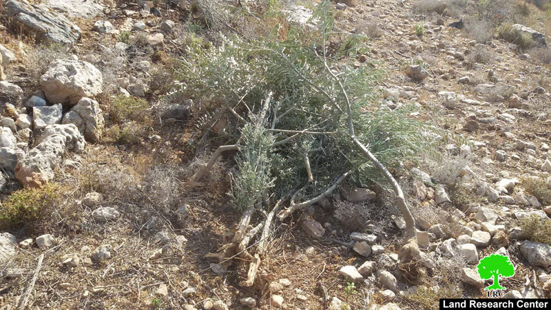
A force from Israel Nature Authority – Israel Civil Administration and an army patrol raided on August 01, 2017 the area known as "Al-Maghybeh" in Wad Qana and uprooted 400 olive trees. Noteworthy, the attacked trees (4-5 years) were reported owned by farmer Ali Abu Ali of Wad Qana.
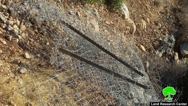
In the same context, the force ravaged a 680m fence that surrounds the targeted parcel and confiscated a water tank that is used for irrigation. Noteworthy, the farmer set up the fence to protect the land from the wild pigs colonists release to destroy Palestinian crops and fields.
|
|
|
|

|

|
|
|
|
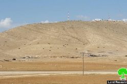
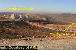
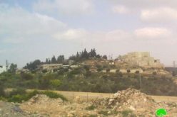
Views of the destruction that followed the attack
Israel Nature Authority claimed that the land is classified as "natural reserve". The uprooted seedlings were moved to unidentified locations via military trucks.
Colonist of the nearby and army troops never stopped attacking the area of Wad Qana and damaging lands and trees. Farmers are, most of the times, denied access to their lands in a step Israel undertakes to take over lands to be used for colonial expansionist plans.
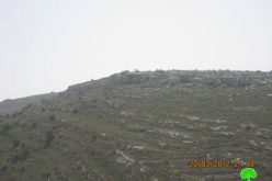
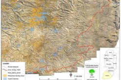
About Wad Qana:
It is located in the northwest part of Deir Istiya and surrounded by: Jinsafut, Kfar Laqif and Azzun from the east, Sinrya and Kfar Thulth form the west, Qarawat Bani Hassan from the south, and Amatin and Deir Istya from the east. Most of Wadi Qana lands are owned by farmers from Deir Istiya. The valley overlooks "Yakir" colony from the southern side and near to is "Nofim" colony. From the north side, there are three colonies surrounding the valley and they are: "Karni Shamron", "Jannat Shamron", and "Maa'ni Shamron".
Wadi Qana is relative to the village of Deir Istiya ( 34,129 dunums) and has a total land area of 10,000 dunums, of which 13 dunums are the built-up area and 11 water springs. Worth mentioning, the place is planted with citrus, olives, and field crops.
The area is a natural slope that is located between two mountains and is famous for water abundance and soil fertility.
The lands of Deir Istiya are classified, according to Oslo accords as follows:
- Area B: it totals around 6132 dunums (18% of the village's total area)
- Area C : it totals around 27997 dunums (82% of the village's total area)
- Noteworthy, Wad Qana lands are all classified as area C.
Prepared by
The Land Research Center
LRC