- Violation: depositing new master plan for an outpost
- Location: Jalud village- Nablus city
- Date: October 07, 2016
- Perpetrators: High Planning Council- Israel Civil Administration
- Victims: owners of targeted lands
Details:
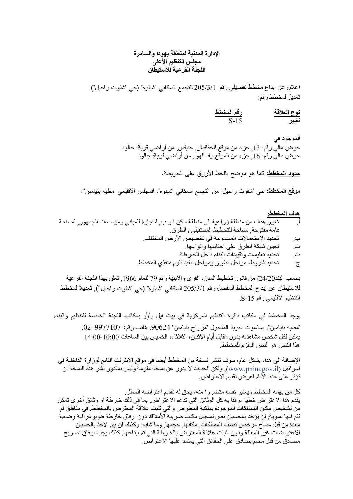
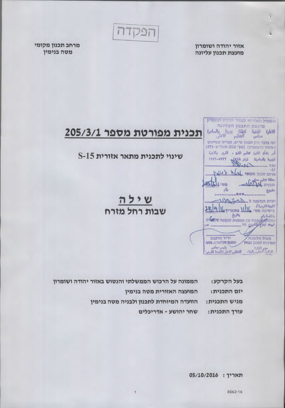
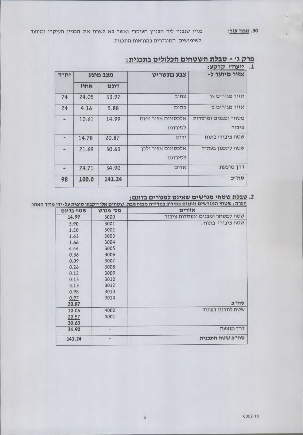
Al-Quds newspaper featured on October 07, 2016 an advertisement for High Planning Council- Israel Civil Administration, which includes the deposit of master plan number 1/3/205 for Shevut Rahel colonial neighborhood in Shilo colony.
The deposited plan included the transfer of agricultural areas into residential areas, commercial sites and road networks.
According to the data of Geographical Information System GIS – Land Research Center and the webpage of Israel Ministry of Interior, the targeted lands total 280 dunums and are founded in Jalud village. Noteworthy, the target area will be used for the construction of 98 residential units.
Photos 1+2: the advertisement featured on the webpage
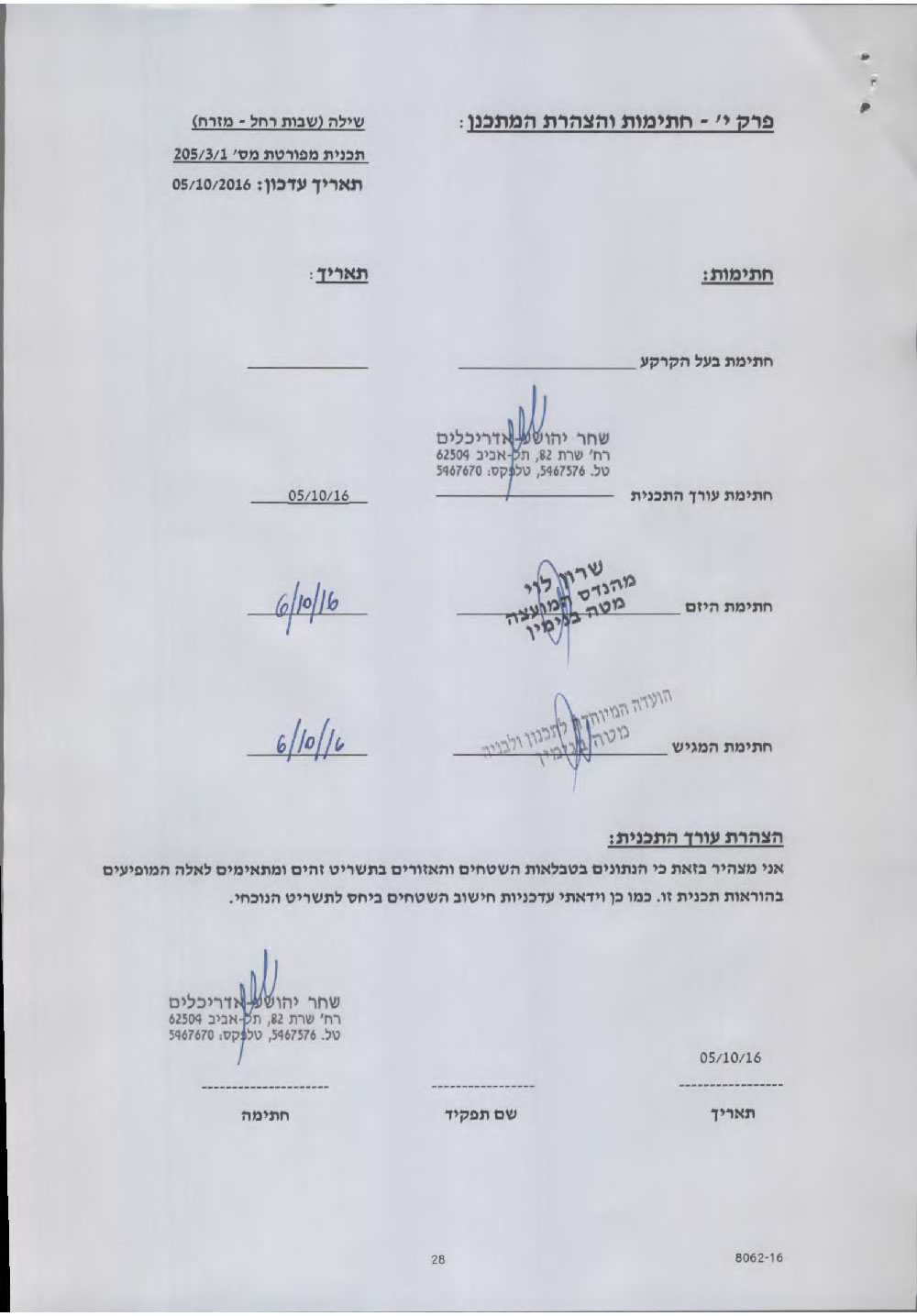
According to the plan signed by the head of the Colonization Sub-Committee, Natalia Aburbukh, and deposited for public objection, the targeted areas were as follows:
- Natural block no. 13 from the locations of Al-Khafafesh and Khneifis in Jalud village
- Natural block np.16 from the location of Wad Al-Hawa in Jalud village
Objectives of the plan:
- Change the status of some lands from agricultural to residential (A &B), commercial, public areas and open areas.
- Determining the uses of lands
- Identifying types of roads and networks
- Determining the specifications and procedures of construction within the plan
- Determining the conditions and steps of the plan's implementation
According to article 24/20 from the law of cities planning of 1966, the plan no.1/3/205 for Shilo neighborhood comes as a modification of the regional master plan no. S-15.

Photo 3: the advertisement featured in Al-Quds newspaper
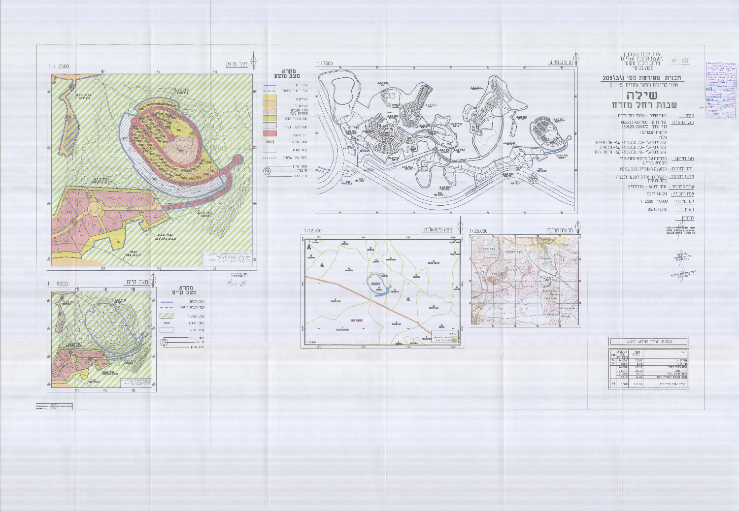
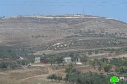
Photos 4-7: the approved master plan and a map of Shevut Rahel colony
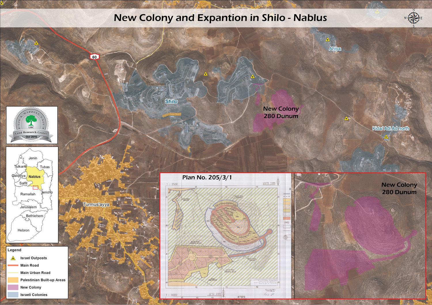
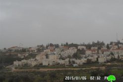
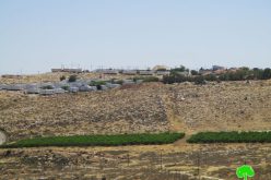
Photo 8: an aerial photo illustrating the targeted lands by the plan
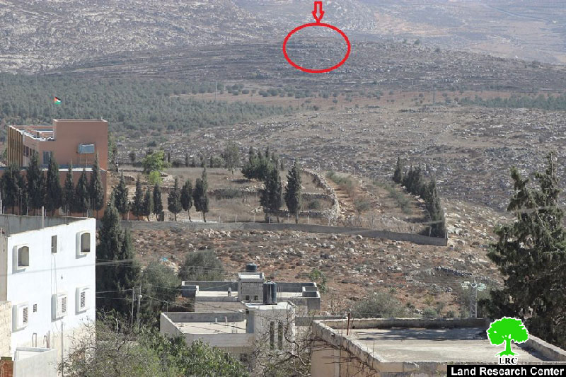
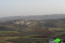
Photo 9: the locations of the targeted lands
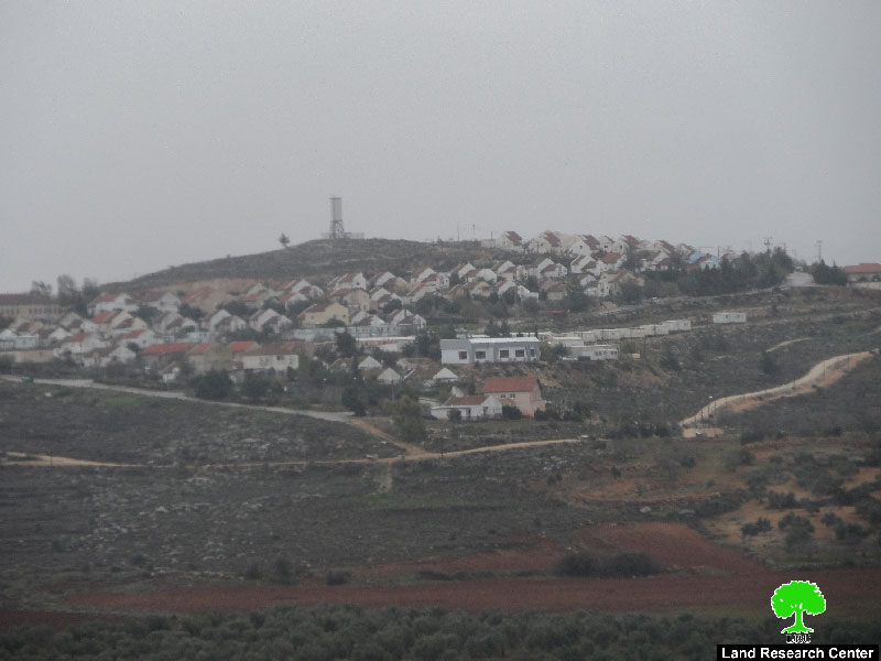
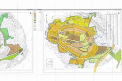
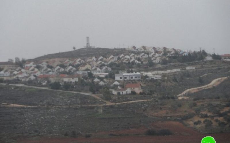
Photo 10: Shevut Rahel colony
The chairman of Jalud village council told Land Research Center the following:
"The targeted area is founded to the east of Shevut Rahel colony and is 200 meters away from it. The seizure will be on 642 dunums from the natural block no. 13 and 40 dunums from the natural block no.16"
He also added: " According to Israeli maps, the plan will target 400 dunums that are one dunum away from Shevut Rahel colony".
The responsible of the colonization file in northern West Bank, Mr. Ghassan Daghlas, told Land Research Center the following:
" The plan will form a linking point between Shevut Rahel colony and the outposts spread all over the area. The plan originally meant to relocate the colonists of Amonah outpost that is founded in Silwad to reside the recently targeted area. In 2013, Israel Supreme Court ruled the eviction of Amonah outpost and the compensation of affected Palestinian farmers, whose lands were seized in there ".
About Jalud:
Jalud is located 29km to the southeast of Nablus city and is edged by Qusra village from the northeast, Qaryut village from the west, Yesh Kodish and Ahya outposts from the east and Shilo colony from the south.
Its population mounts up to 598 people (2014 census). Jalud's total land area is 22,473 dunums, of 80 dunums are considered the village's built-up area.
Israeli colonies confiscated 2227 dunums from Jalud lands. Shilo colony that was established in 1978 confiscated 640 dunums from the village. Mizpe Rahel colony and other outposts namely (Yesh Kodish, Ahya, Eli, Adi Ad and Kida) are founded on confiscated lands from the villg.
Bypass roads confiscated around 436 dunums from the village.
The lands of Marda are classified according to Oslo Accords as the following:
- 5541 dunums (25%) are classified as area B
- 16932 dunums (75%) are classified as area C
Prepared by
The Land Research Center
LRC