Israel uses State Land Declarations to establish a new Israeli industrial zone on lands of west Ramallah villages
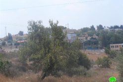
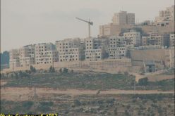
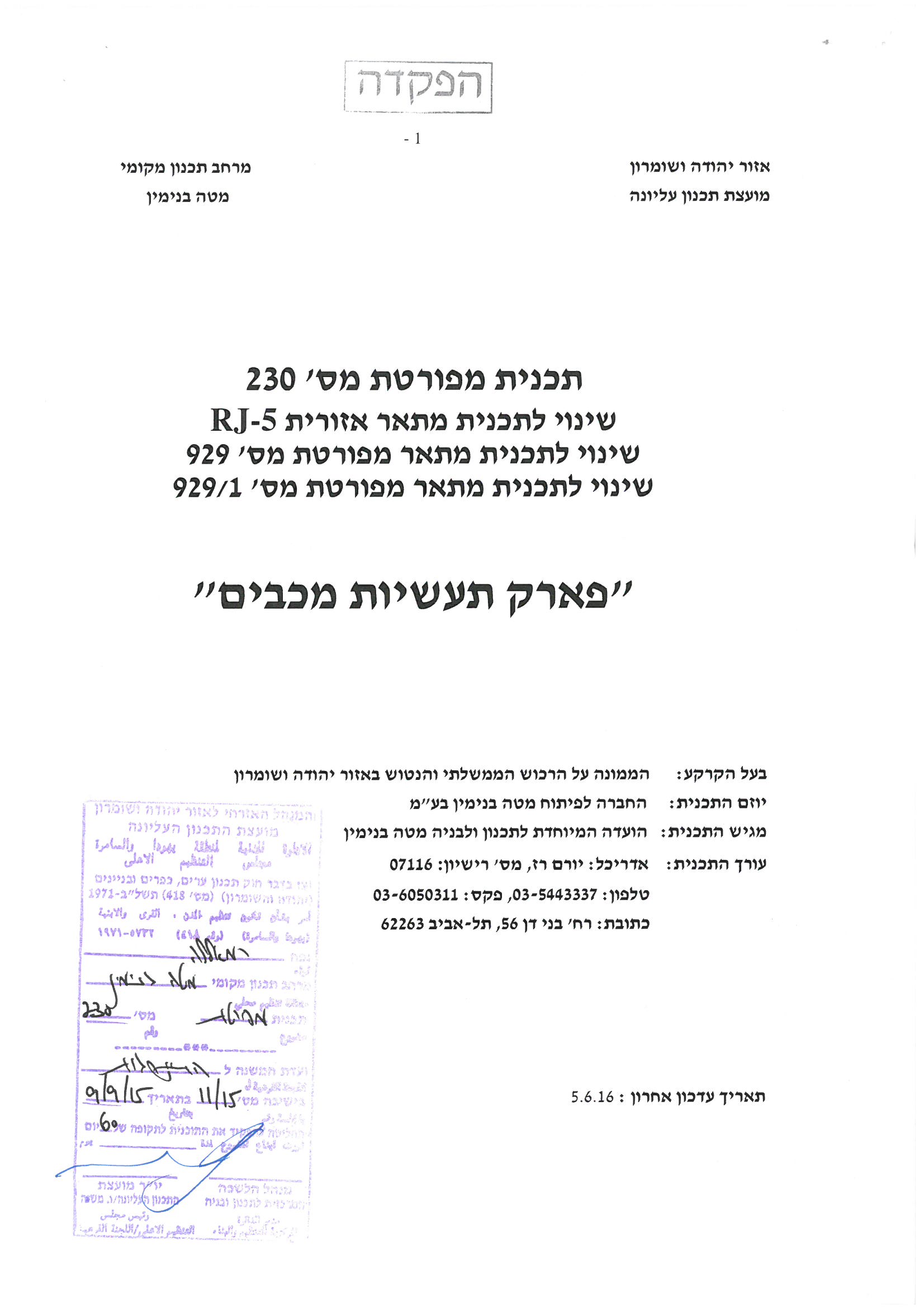
In July 2016, the Israeli occupation authorities verbally notified Palestinian land owners in West Ramallah villages of their intention to confiscate land in the area to establish a new Industrial zone. A thorough analysis conducted by the Applied Research Institute – Jerusalem (ARIJ) of the targeted area revealed that on the 21st of June 2016, the director of planning at the Israeli ministry of finance has deposited Town Planning Scheme (TPS) No. יוש/ 230 which states the establishment of an industrial zone on lands of Saffa, Beit Sira and Beit Ur At Tahta villages, where the village of Saffa is the most targeted in terms of the area that is going to be confiscated from the village. See Photos 1 & 2 and Table 1
Photos 1 & 2: details of plan No. יוש/ 230
|
Table 1: Palestinian Land threatened of confiscation in West Ramallah villages |
||
|
Area of Land threatened of confiscation (Dunums) |
Village Name |
No. |
|
206.4 |
Saffa |
1 |
|
29.3 |
Beit Sira |
2 |
|
82.6 |
Beit Ur At Tahta |
|
|
318.3 |
Total |
|
|
Israeli Ministry of Interior |
||
Israel claims that the aim behind establishing the industrial zone is to create work opportunities in the area, as well for Palestinians; however, further analysis of the plan showed that Israel has previously declared the site intended for the Industrial Zone as “State land”, and hence trying to make use of that declaration to turn the area into an industrial and operational zone that will be operated in the future by the nearby Modi’in Illit settlement bloc.
The plan was signed by Eng. Natalia Orbuch, head of the so-called “Israeli Settlement sub-committee at the Israeli Civil Administration” in the occupied Palestinian territory and states the following:-
|
“Announcement of the deposit of detailed map of Town Planning Scheme No. יוש/ 230 in Mateh Benjamin Regional Council – "Maccabim Industries Park" (Industrial and Operational Zone – Horon Junction / Kharbatha), which constitutes a change in the following maps
Parcels and locations in the Mateh Benyamin Regional council :
Location:
|
Provisions of the plan:-
- Establishing an industrial and operational zone in Horon Junction area
- Change in land use from Agricultural to : Industrial, trade and transportation, buildings and Public facilities, open space, public park, parking and roads.
- Determination of various permissible land Uses.
- Setting limits and provisions in the area with regard to construction plan.
- Outlining the various road network classification.
- Determining conditions, stages of implementation and development phases required for the operational agency.
The plan states that “according to chapter No. 20/24 of the Israeli City, Village, and Building Planning Law no. 79 of 1966, the Israeli settlement sub-committee declares the deposit of the Town Planning Scheme (TPS) No. יוש/ 230 in Mateh Benjamin Regional council under the name " Maccabim Industries Park " (Industrial and Operation Zone – Horon Junction / Kharbatha), in addition to a change in the Regional Master Plan No. RJ-5 and Regional Master Plan No. 929 and a change in detailed map No. 929/1”.
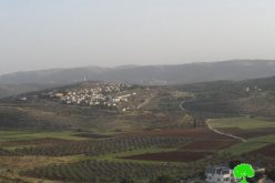
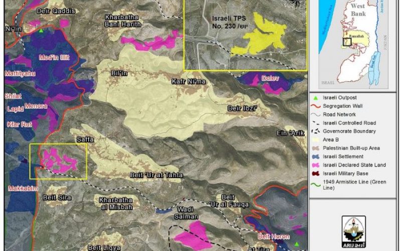
The plan further indicates that “anyone who has interest in the plan and considers himself /herself affected, has the right to file his/her objection. A written objection must be submitted and supported by all the documents that support his/her objection including a map of the area or any other document that can identify the location of the property and land and its relation to affected land owners" … "Affected owners must also attach a certified statement by a lawyer who attests the reasons upon which the objection was submitted." See Photos 3-7
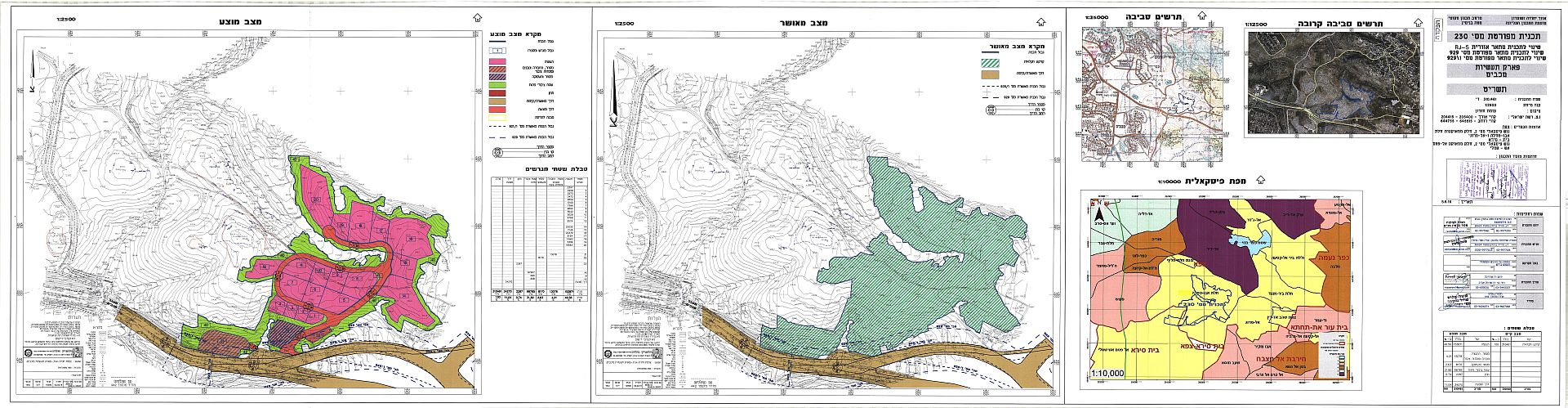
Photos 3-7: Details of Plan No. יוש/ 230
|
Table 2: Details of Plan No. יוש/ 230 – the proposed Israeli Industrial zone on lands of Saffa, |
|||
|
No. |
Type of construction |
Area |
Percent |
|
1 |
Industry |
153.078 |
49.56 |
|
2 |
Trade, transportation ,buildings and public institutions |
13.078 |
4.21 |
|
3 |
Trade and Employment |
8.170 |
2.63 |
|
4 |
Open Space |
98.785 |
31.82 |
|
5 |
Parking |
2.287 |
0.74 |
|
6 |
Roads |
34.270 |
11.04 |
|
Total |
310.461 |
100 |
|
|
Source: Israeli Ministry of Finance, 2016 |
|||
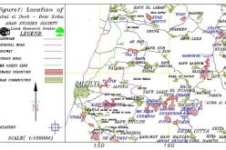
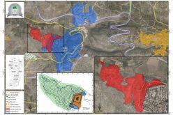
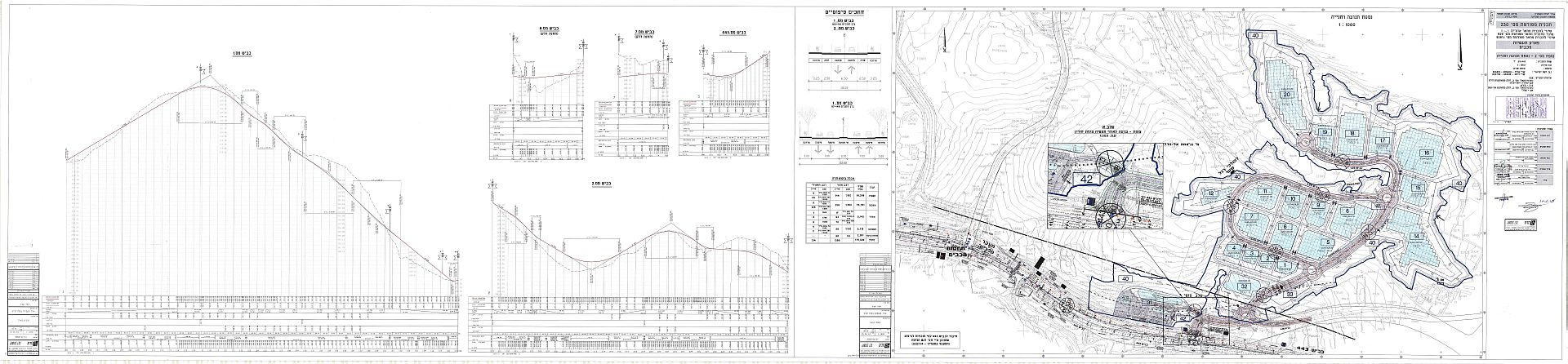
The construction of the new industrial zone on lands of west Ramallah villages will promote Israeli settlements in the area[1] and facilitate their complete integration in terms of living standards; while on the other side, the plan will have negative impact on the neighboring Palestinian communities as the construction of the industrial zone will restrict the potential for growth and development for the neighboring Palestinian communities in that specific location and will allow for more land expropriation in the area. See Map 1
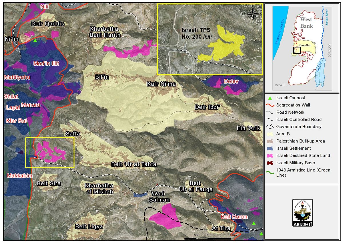
Map 1: Location of the Israeli Industrial Zone on lands of West Ramallah villages
To conclude,
Throughout the years of the occupation, Israel has made use of the “State land declarations” in the occupied West Bank to further consolidate its control of the Palestinian land and preserve it for future settlement expansion and development. By doing so, Israel shows no respect to the obligations of the international law imposed on an occupying power and continues to violate them, including the United Nations Resolutions and the Laws of War and Occupation as stated in the Fourth Geneva and Hague Conventions.
For more information about state land declarations,
- Ecstasy vs. Siesta: Israel Ecstatic vs. International Community Siesta & the Two-State Solution RIP
- Israel to Activate "Absentee Property Law" to Steal Palestinian Lands in Occupied East Jerusalem
[1] Mainly Israeli settlements in the Mod’in Illit settlement bloc.
Prepared By
The Applied Research Institute – Jerusalem
ARIJ