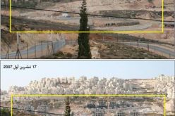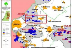
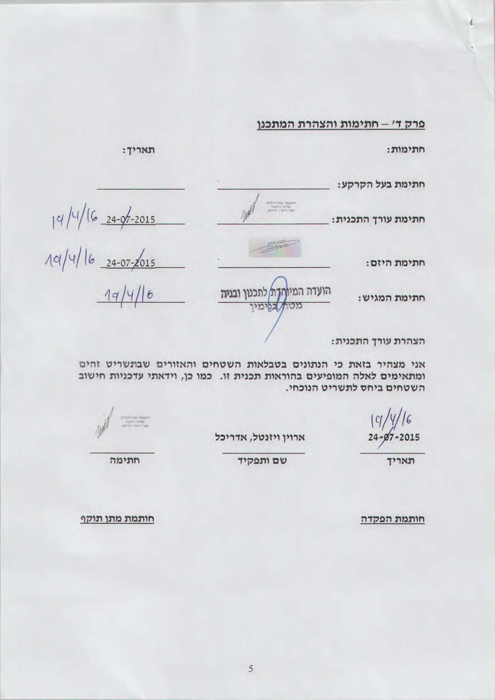
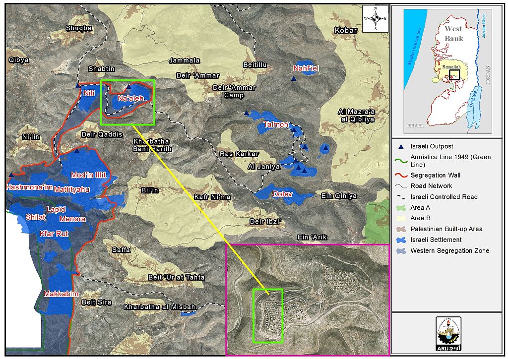
On the 13th of July 2016, the Israeli occupation Bulldozers backed by army forces commenced a large scale land razing in Deir Qiddis village west of Ramallah Governorate, to expand the nearby Na’ale Settlement located on the northern edges of Deir Qiddis Village. Villagers and affected Palestinian land owners stated that the expansion is being implemented based on a previously approved Town Plan scheme in the settlement. Analysis conducted by the applied Research Institute – Jerusalem (ARIJ) to the affected area showed that on the 13th of April 2016, the Israeli Land Administration published on its website the Town Plan Scheme (TPS) No. (207/2/1) which states the construction of additional housing units to the already existing settlement neighborhood “ Giv’at Dromit” in Na’ale Settlement. The TPS was deposited for approval to the Israeli settlement sub-committee on the 27th of May 2015, and was approved in 2016. The construction is being implemented by Holly Ervin Wiesenthal company. See Photo 1
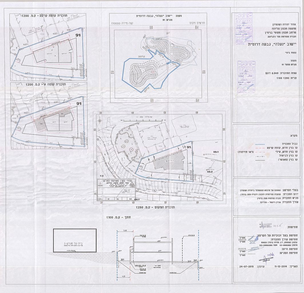
Photo 1: TPS No. (207/2/1) in Na’ale Settlement which targets Parcels No. 91 in Deir Qiddis village
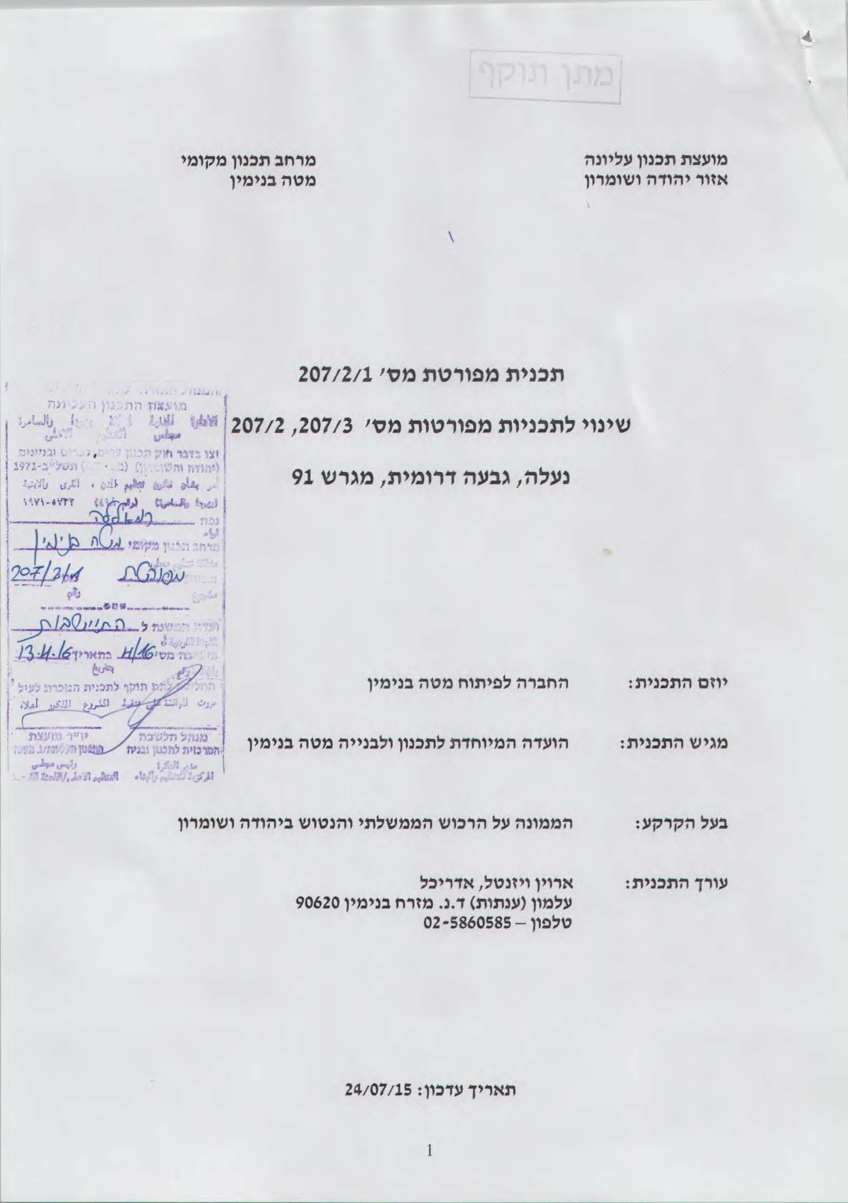
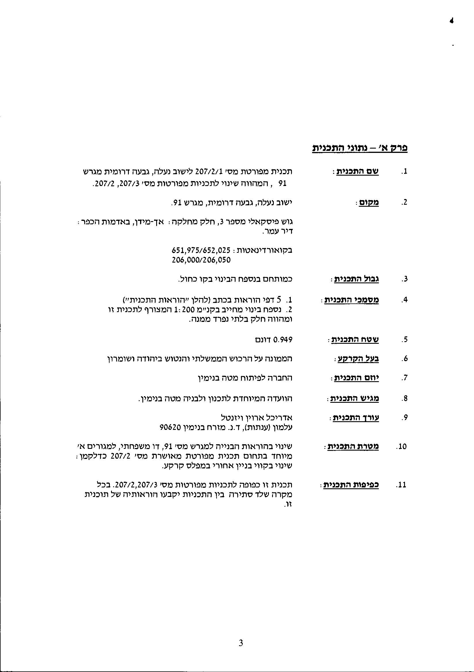
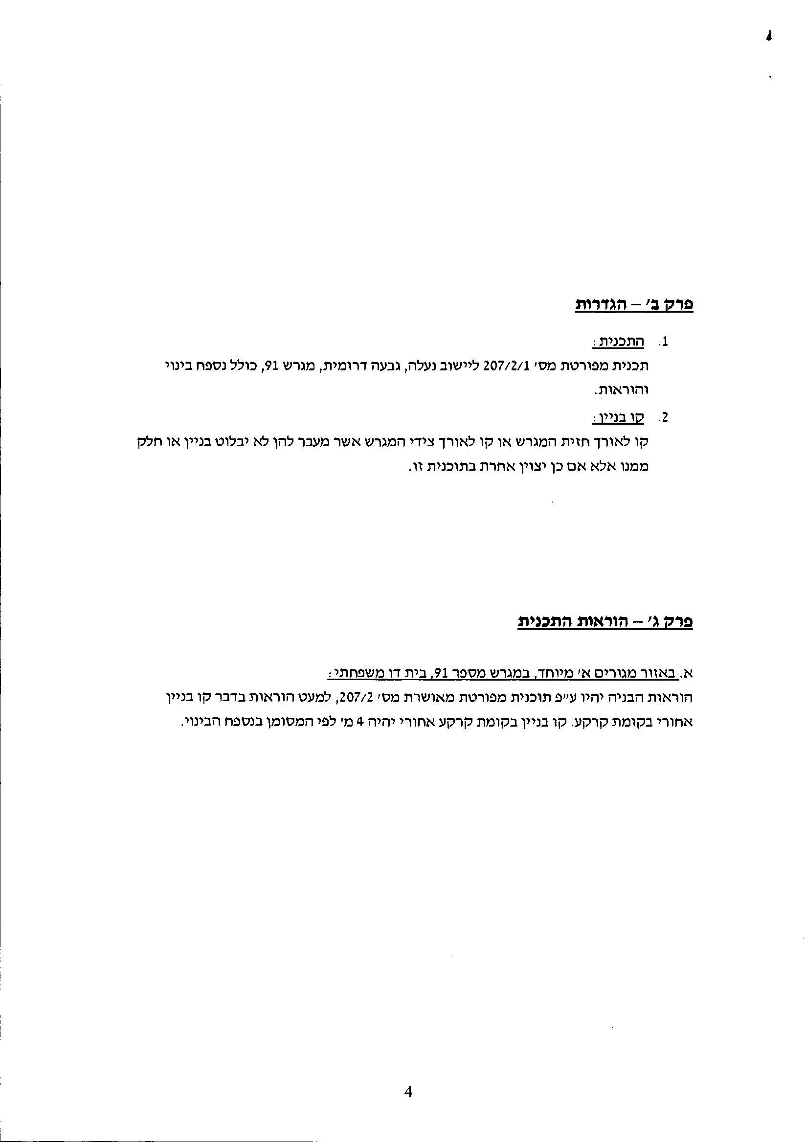
Photos 1-4: Details of TPS No. (207/2/1)
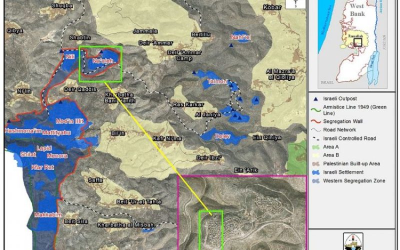
Map 1: TPS No. (207/2/1)
Below is a detailed information of the plans that have been deposited and approved in Na’ale settlement since its establishment.
|
Table 1: Plans approved in Na’ale Settlement north of Deir Qiddis village |
||||
|
Settlement |
TPS No. |
status |
Purpose |
Land Reserved by the plan (Dunums) |
|
Na'ale |
207 |
It was approved in 07.18.84 |
Determination of areas and land reserves (Resi dential – 322 Units) |
1209.774 |
|
Na'ale |
207/1 |
It was approved in 01.18.89 |
Assigning a residential development area (Residential – 276 units) |
286.28 |
|
Na'ale |
207/1/1 |
It was approved in 14.05.97 |
Determining zoning (Public Institutions and Road Area) |
24.517 |
|
Na'ale |
207/2 |
It was approved in 07/07/99 |
Residential zoning change which included an increase in land reserved for public buildings, Civic Centers and Sports Area) |
670.763 |
|
Na’ale |
207/2/1 |
It was appoved on 13/04/16 |
A Change in the construction field (a Two family residential complex) |
Parcel No. 91 |
|
Na'ale |
207/3 |
It was approved in 07.18.12 |
Change User |
A Change in the building Residential Area |
|
Source: Israeli Land Administration, |
||||
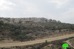
A Glance about Na’ale Settlement
It was established in 1982, on lands of Deir Qiddis, Shabatin and Deir Ammar. The settlement occupies a total land area 895 dunums of the aforementioned village and today is home to 1495 Israeli settlers.
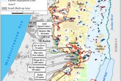
The construction of the Israeli Segregation Wall in the occupied West Bank will set the settlements of Na’ale and nearby Nili settlement on the western side of the wall, in the area isolated between the 1949 Armistice Line and the path of the Israeli Segregation Wall[1], and connect the two settlements with the nearby settlement bloc., Modi’in Illit (Kiryat Sefer) via the Israeli bypass road 446.
To sum up,
Israeli settlement activities in the occupied territories have a devastating consequence on the living conditions of the Palestinian people, and that situation is deteriorating as Palestinian continue to witness the loss of their lands and consequently a vital source of living, posing a serious threat to peace in the whole area.
Additionally, the Israeli settlement expansion policy disregards and undermines the international norms, conventions and agreements and continues to create new facts on the ground with each passing day, the thing that raises the question about whether Israel’s ultimate goal is in fact land grab and segregation, thereby undermining any prospect of a viable peace agreement with the Palestinians in the future.
[1] The area which has become known to the Palestinians as “the Western Segregation Zone)
Prepared By
The Applied Research Institute – Jerusalem
ARIJ